Geography of India
The landmass of the world is divided into seven continents North America, South America, Europe, Africa, Asia, Antarctica, and Australia. India is a country in the southern part of Asia. The equator divides the globe into the Northern and southern hemispheres. India is present in the northern part of the globe.
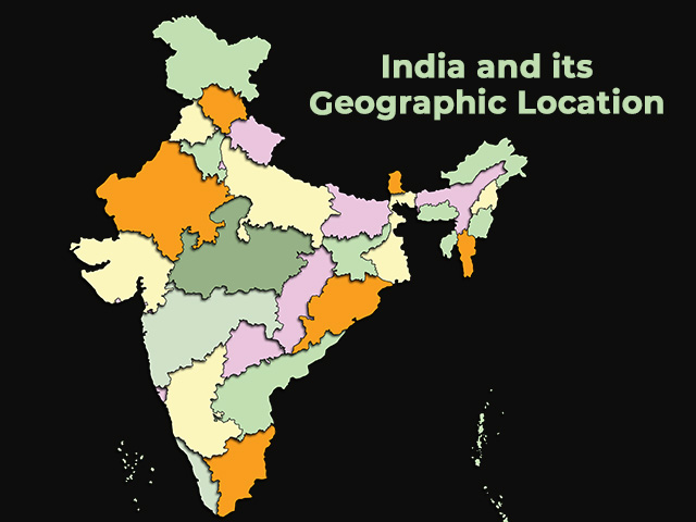
India and its Geographical Location
Basic Information about India
Geographical Location of India
India lies between the latitude 804’N and 3706’N and longitude 6807’E and 97025’E. India is divided into almost two equal parts by the tropic of cancer.
Importance of Location of India
India is a special country from the point of view of trade because it is present in the center of Asia. India acts as the bridge between the western developed countries in Europe and the eastern developing countries of South East Asia. The distance between India and Europe is reduced by 7000km due to the opening of the Suez Canal in 1869. India is easily accessible to every country in the world because of this strategic central position.
Measurement India
The area of India is about 3.28 million square km. The area of India is about 2.4% of the total world area. India is the 7th largest country in the world. The total coastline of India including the boundary of islands is 7,516.6 km. The length of the coastline of India excluding the boundary of islands is 6,100 km. The distance between the northernmost point and the southernmost point is 3214km. The distance between the westmost point and the eastmost point is 2933.
Indian standard Meridian
The time at a particular location depends upon the longitude. There is a difference of 2 hours between Gujarat and Arunachal Pradesh. To have uniform time throughout the country the time according to the Indian standard meridian which is 82030E is taken as the standard time for the whole country.
List of Neighboring Countries of India
India has seven land neighbors namely Pakistan, Afghanistan, China, Nepal, Bhutan, Bangladesh, and Myanmar, and two sea neighbors Sri Lanka and the Maldives.
The following table shows how many borders India shares with its neighbor.
| Sr.no | Border | Length of border |
| 1 | India-Pakistan border | 3,323km |
| 2 | India-China border | 3,248km |
| 3 | India-Nepal border | 1,751km |
| 4 | India-Bangladesh border | 4096.7km |
| 5 | India-Bhutan border | 699km |
| 6 | India-Myanmar border | 1,643km |
| 7 | India-Afghanistan border | 106km |
Political Division of India
From the point of view of administration, India is politically divided into 28 states and 8 union territories
The list of states is given below.
- Andhra Pradesh
- Arunachal Pradesh
- Assam
- Bihar
- Chhattisgarh
- Goa
- Gujarat
- Haryana
- Himachal Pradesh
- Jharkhand
- Karnataka
- Kerala
- Madhya Pradesh
- Maharashtra
- Manipur
- Meghalaya
- Mizoram
- Nagaland
- Odisha
- Punjab
- Rajasthan
- Sikkim
- Tamil Nadu
- Telangana
- Tripura
- Uttar Pradesh
- Uttarakhand
- West Bengal
List of Union Territories of India
- Jammu and Kashmir
- Ladakh
- Delhi
- Chandigarh
- Puducherry
- Dadra and nagar haveli and Daman and Diu
- Lakshadweep
- Andaman and Nicobar Islands
Physiographic Divisions of India
On the basis of Physical features, India is divided into six region
- The northern and northeastern mountains: This includes the three mountain ranges of the Himalayas. They are present in the northern and northeastern regions of India
- The northern plain: They are present in the southern part of the Himalayas.
- The peninsular plateau: As we go from north to south. India becomes tapered the triangular plateau present in the south of the northern plain is called the peninsular plateau.
- The Indian Desert: This desert is known as the Thar desert it is present in Rajasthan
- The Coastal plains: The plains present between the Arabian Sea and the Western Ghats are called the western coastal plain. The plain present between the Bay of Bengal and the Eastern Ghats is called the eastern coastal plain.
- The islands: geographical features of India include two islands group Lakshadweep island in the southwest of the Arabian Sea and Andaman Nicobar island in the southeast in the Bay of Bengal.
FAQ About Geography of India
Ans: India lies between the latitude 804’N and 3706’N and longitude 6807’E and 97025’E on the Globe.
Ans: From the point of view of administration, India is politically divided into 28 states and 8 union territories.
Ans: The area of India is about 3.28 million square km.
Ans: India has seven land neighbors namely Pakistan, Afghanistan, China, Nepal, Bhutan, Bangladesh, and Myanmar, and two sea neighbors Sri Lanka and the Maldives.
Ans: Rajasthan is the largest state in India by area.


